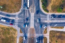
Current official data can identify Meridian intersections with high counts of fatal or serious-injury crashes, but it cannot prove one junction is the city’s “most dangerous.” COMPASS’s 2018–2022 Appendix D lists seven Meridian intersections with three to five such crashes and gives Meridian Road/Amity Road five. The same memo’s Table 4 says six for that location without explaining the difference. This guide uses Appendix D for its consistent row-level table, discloses both figures, and explains the method, limits, and current project context.
Meridian intersections in one consistent official dataset
The COMPASS Regional Safety Action Plan was accepted in February 2025. Its High Injury Network analysis joined five calendar years of crash records to a modeled regional road and junction network. The table below includes every row classified as “Meridian” in Appendix D’s high-K/A intersection table. It excludes Meridian Road and Lake Hazel Road because COMPASS classifies that row as Ada County rather than Meridian.
Why five appears in the table below: Technical Memorandum 4’s Table 4, “Location-Specific Strategies—Top 10 Locations,” reports six K/A crashes for Meridian Road/Amity Road. Appendix D’s dedicated intersection row reports five. The memo connects both tables to the same High Injury Network screening but gives no separate crash window, junction boundary, manual adjustment, or location note that reconciles the one-crash difference. Appendix D expressly documents an assumed reassignment at Idaho Center Boulevard/Franklin Road, but provides no comparable explanation here. The source is therefore internally inconsistent. The current public COMPASS junction layer independently reports five at the Meridian/Amity point—zero fatal and five serious-injury crashes—but does not explain Table 4’s six. We retain Appendix D’s five for the consistent row-level comparison and annualized calculation, preserve Table 4’s six as an unresolved alternate figure, and do not add or average the two values.
| Five-year count group | Intersection | Major-road owner | Annualized historical count |
|---|---|---|---|
| 5 | Meridian Road (SH-69) / Amity Road | ITD | 1.0 per year |
| 4 | Eagle Road / Overland Road | ITD | 0.8 per year |
| 4 | Locust Grove Road / Overland Road | ACHD | 0.8 per year |
| 4 | Ten Mile Road / Cherry Lane | ACHD | 0.8 per year |
| 3 | Fairview Avenue / Locust Grove Road | ACHD | 0.6 per year |
| 3 | Meridian Road / Pine Avenue | ACHD | 0.6 per year |
| 3 | Meridian Road (SH-69) / Victory Road | ITD | 0.6 per year |
Measure: Each displayed count is Appendix D’s sum of crashes classified as fatal (K) or serious injury (A) during 2018–2022. The annualized column divides that five-year Appendix D count by five. It is a historical time average, not a traffic-exposure or accident-probability rate. Table 4’s unreconciled six for Meridian/Amity is disclosed but not used in the calculation. Ties are alphabetical; they are not broken with an unrelated score.
How COMPASS assigned and selected the intersection crashes
The junction area is 150 feet, not an unlimited corridor
COMPASS treated a crash within 150 feet of a modeled junction as junction-related and assigned it exclusively to that junction. Other crashes went to the nearest segment. The network analysis focused on collectors and higher road classes, excluding local roads, interstates, and ramps. Regionwide, 148 fatal or serious-injury crashes were not joined because they were on local roads or outside the buffered features; 13 may have been poorly geocoded.
The numerator is clear; a verified traffic denominator is not
The numerator is the K/A crash count. The time denominator for the annualized figure is five years. The published intersection rows do not provide a verified vehicle, trip, annual-average-daily-traffic, or vehicle-mile denominator. The methodology’s data dictionary expressly labels its crash-rate fields as not quality-controlled or verified. This article therefore groups intersections by the published count and does not say that one driver is more likely to crash at one listed junction than another.
The High Injury Network score is not a crash rate
The plan also combines a normalized historical location score with a systemic risk score based on correlated roadway features. COMPASS weights those components equally and includes scores more than one standard deviation above the network. That model helps agencies screen locations; it does not establish causation, predict an individual crash, or decide civil responsibility. City-to-city counts and population rates belong in our separate Idaho car-accident statistics study.
What current plans and maintenance notices do—and do not—show
Project activity is not proof that a location remains dangerous or has become safe. It should be tracked separately from the historical crash table.
| Official item | Current source statement | Important limit |
|---|---|---|
| Cherry Lane, Ten Mile Road to NW 8th Street | ACHD’s August 20, 2026 update lists the pavement-maintenance segment as complete. | The project page does not describe a Ten Mile/Cherry intersection redesign or publish post-project crash results. |
| Major signalized arterial intersections | COMPASS recommends a package that may include protected left-turn phasing, leading pedestrian intervals, accessible pedestrian signals, restrictions on right turns on red, bike boxes, raised islands, or removal of channelized right turns. | The strategy memorandum is a planning recommendation, not evidence that a specific item is funded, designed, approved, or built. |
| Meridian Intersection and Pedestrian Safety Task Force | The 2023 city task-force report says more than 140 sites were reviewed through crash data, field observations, lighting review, public feedback, and detailed intersection audits. | The task force focused on people walking, bicycling, and using other non-vehicle modes. Its audit should not be merged with the later COMPASS K/A count table as though the methods were identical. |
Roadway responsibility is shared among agencies. Check current construction notices with the owning agency identified in the data table instead of assuming a past plan is current.
A severe-crash table cannot determine fault in a Meridian collision
Historical location data does not show what a signal displayed, who had the right of way, whether visibility was obstructed, or how each road user acted in a particular crash. Those issues require case-specific evidence. Our guide to fault determinations after an Idaho car accident explains why a citation or police report is relevant but not a civil judgment.
- Call 911 when someone may be injured or traffic conditions make the scene unsafe.
- If it is safe, photograph the signals, signs, lane markings, vehicle positions, sight lines, debris, and temporary traffic controls.
- Record the exact intersection, travel direction, lane, date, and time.
- Save dash-camera files and identify nearby traffic, business, or doorbell video before routine deletion.
- Request the record from the correct agency; our Meridian accident-report guide explains the agency distinctions.
If you were injured and want help assessing the evidence, our Idaho car-accident attorneys can explain the process. No table can promise a finding of fault or a case outcome. You may request a consultation when you are ready.
Methodology and update schedule
- Primary crash source: Idaho crash records analyzed by COMPASS for 2018–2022.
- Geography: Every high-K/A Appendix D junction row labeled “Meridian”; source roadway owner labels are preserved.
- Selection: Count groups, descending; tied intersections shown alphabetically. This is not a census of all Meridian junctions.
- Calculation: Appendix D K/A count divided by five for annualized historical context. No unverified traffic-exposure rate is republished.
- Source-consistency rule: Appendix D supplies every row-level comparison. Table 4’s six-crash Meridian/Amity figure is retained separately as unresolved; it is not merged with Appendix D’s five.
- Last data check: September 2, 2026.
- Review owner: Attorneys of Idaho content operations.
- Next scheduled check: June 30, 2027, or earlier if COMPASS or ITD publishes a replacement High Injury Network dataset.
Download the Attorneys of Idaho companion files: Meridian 2018–2022 severe-crash comparison CSV, Meridian current-project context CSV, and Meridian research methodology CSV. These Attorneys of Idaho research companions organize information from the cited sources; they are not official agency datasets or raw crash records.
Sources and Legal References
- COMPASS, Regional Safety Action Plan (current plan page; accepted February 2025; page updated May 4, 2026).
- COMPASS Technical Memorandum 3: Existing Conditions (October 8, 2024; 2018–2022 data, methods, exclusions, and definitions).
- COMPASS Technical Memorandum 4: Strategy Development (September 16, 2024; Table 4 reports six K/A crashes at Meridian/Amity, while Appendix D reports five and provides no reconciliation; also supports the intersection dataset and jurisdiction strategies).
- COMPASS, Final RSAP Junctions for Dashboard (current public junction layer; the Meridian/Amity point reports five K/A crashes: zero fatal and five serious injury; service metadata last edited June 3, 2025).
- City of Meridian, Intersection and Pedestrian Safety Task Force Report (2023).
- Ada County Highway District, 2026 Large Patch Program (updated August 20, 2026).
This article provides general information, not legal advice. Crash histories and project plans can change, and a location-level statistic does not establish fault in an individual case.
Legal review
Legal reviewer
Reviewed by J.W. Bond , Founding Attorney and Partner on September 2, 2026.